The Geospatial and Big Data Sciences Cluster at ICRISAT employs a diverse range of tools and technologies to harness the power of geospatial information and big data analytics in agricultural research and decision-making. Our cluster is at the forefront of utilizing cutting-edge tools to extract valuable insights and drive innovation in the field of agriculture.
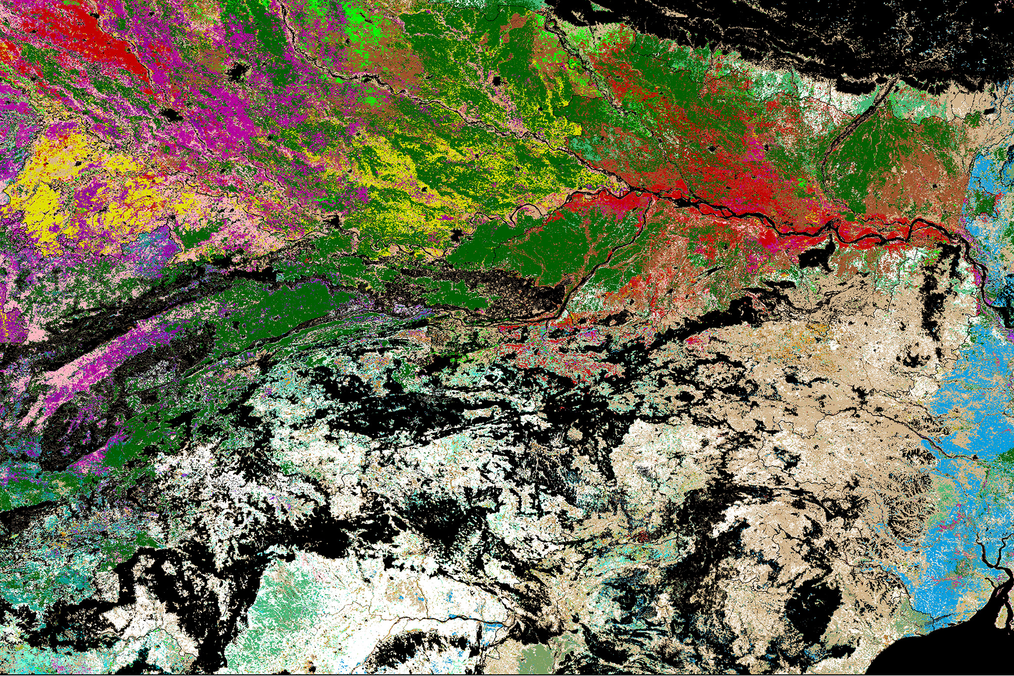
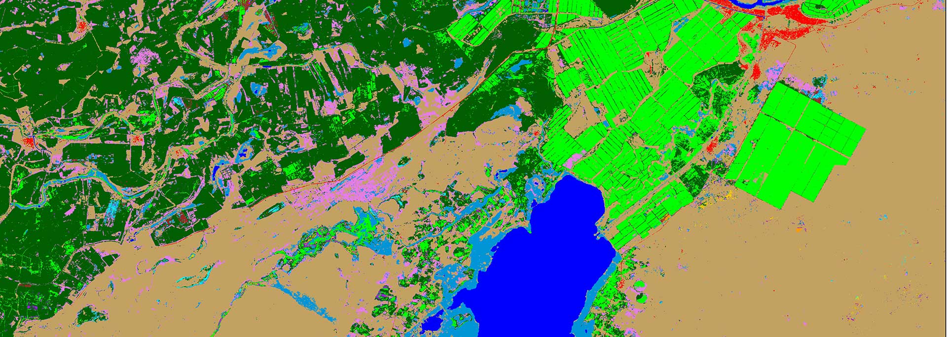
Geographic Information System (GIS): GIS technology is used to map and analyze spatial data, allowing for precise identification and characterization of landscapes, including soil types, land use patterns, and water resources. This information helps in identifying areas for targeted interventions and technology scaling
Remote Sensing and GIS: We extensively use remote sensing technologies, such as satellite imagery and aerial photography, to capture spatial data on various agricultural parameters. Geographic Information System (GIS) tools enable us to analyze, integrate, and visualize geospatial data, providing valuable insights into land use, crop distribution, and environmental factors.
Machine Learning and Artificial Intelligence: To process and analyze vast amounts of data, we employ machine learning (ML) and artificial intelligence (AI) algorithms. These advanced techniques enable us to derive patterns, identify relationships, and make accurate predictions in areas such as crop yield estimation, pest and disease detection, and land cover classification.
Big Data Analytics: The GSBD Cluster leverages big data analytics to process and analyze large and complex datasets. Through data mining and advanced analytics techniques, we derive actionable insights that inform decision-making and drive agricultural innovation. Our cluster utilizes state-of-the-art platforms and tools for big data processing and analysis, ensuring the highest quality and efficiency in our research endeavors.
Internet of Things (IoT) and Sensor Technologies: We incorporate IoT and sensor technologies to collect real-time data on various agricultural parameters. These technologies enable us to monitor soil moisture, climate conditions, crop health, and other critical variables. By combining this data with geospatial information, we gain a comprehensive understanding of the agricultural landscape and can make data-driven recommendations for resource management and crop optimization.
Crop Modeling: Crop modeling plays a crucial role in our research activities. By integrating geospatial data, climate information, and crop physiology, we develop models that simulate and predict crop growth, yield, and response to different management practices. These models assist in optimizing agricultural practices, resource allocation, and decision-making for sustainable crop production.
Open-Source Software and Data Platforms: We actively utilize open-source software and data platforms to enhance our research capabilities. These platforms provide access to a wide range of tools, algorithms, and datasets, fostering collaboration, reproducibility, and innovation. We contribute to the open-source community by sharing our findings, methodologies, and tools to facilitate knowledge exchange and advancements in the field.
Collaborative Tools and Visualization: To enhance collaboration and knowledge sharing, we leverage various collaborative tools and visualization techniques. These include online platforms for data sharing, interactive dashboards for visualizing spatial information, and collaborative environments for team collaboration and project management.
We invite researchers, professionals, and stakeholders to explore our cutting-edge tools and technologies. Through our innovative approaches and advanced tools, we strive to unlock the potential of geospatial and big data sciences for sustainable agriculture, environmental management, and food security.